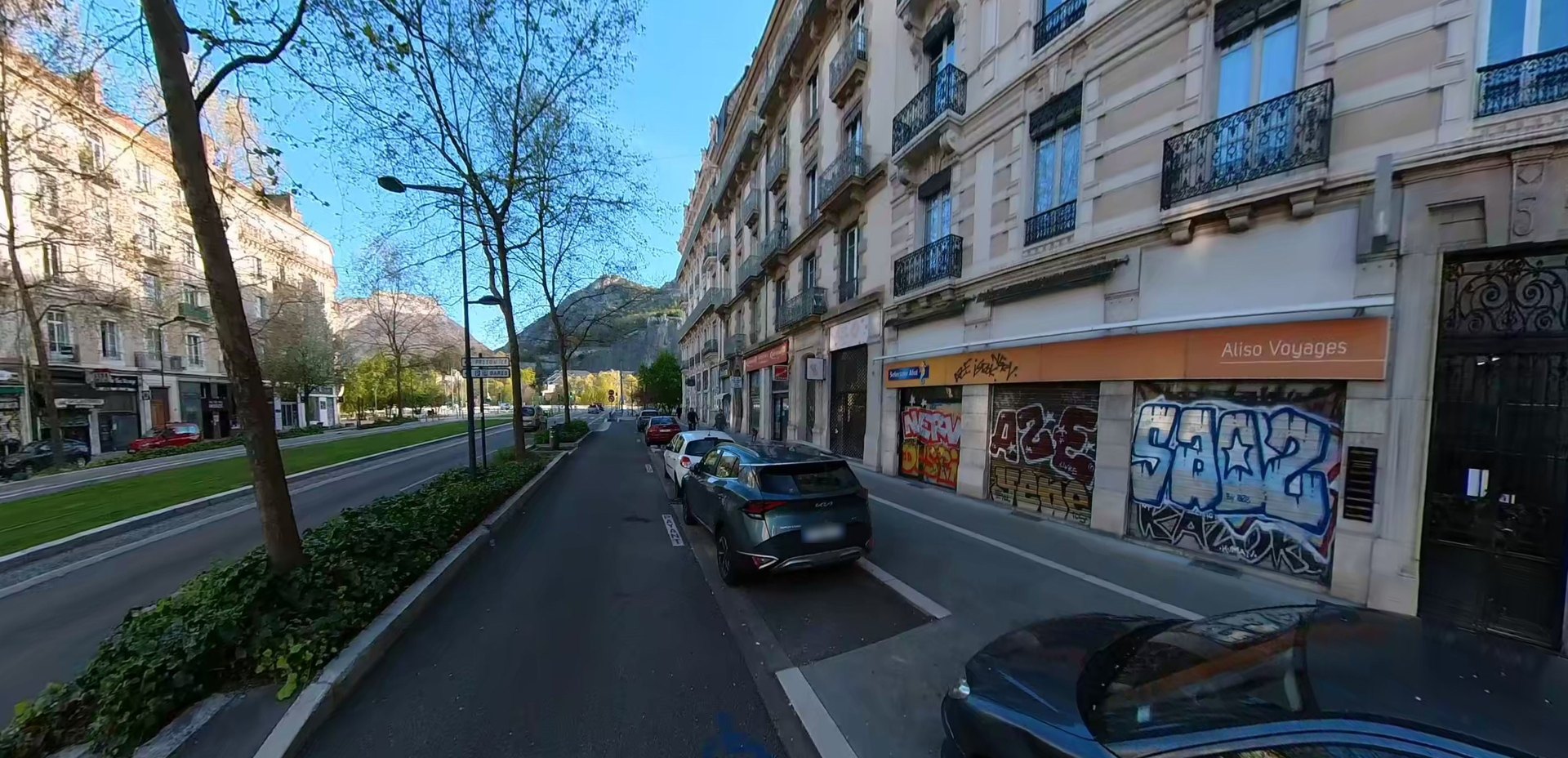
360° camera, artificial intelligence, interactive map. Rando360 is launching a pilot project to document and locate tags and graffiti across the streets of Grenoble, and is looking for partners to extend it to the whole city.
A reality that's hard to ignore
Walking through Grenoble with our 360° camera, one thing quickly became clear: tags and graffiti are present in virtually every street. Building façades, garage doors, street furniture, electrical boxes, retaining walls, tram stops… untouched surfaces are the exception. This isn't a phenomenon confined to a few neighbourhoods: it runs through the city centre, residential areas and everyday pedestrian routes.
Rather than simply observing it, we decided to measure, document and make it visible, and to demonstrate the approach through a first pilot project.
A pilot project to prove the concept
This first project is deliberately designed as a sample, a full-scale test on a limited area of the city. The goal is to validate the entire technology chain, from field capture to the final map, before considering a larger deployment across all of Grenoble.
The pilot's results already speak for themselves. Even on a partial area, the density of degradation recorded exceeds what informal observation would suggest. The map shows it unambiguously.
How we did it
The project relies on a combination of three technologies we assembled ourselves.
Field capture
Each street is filmed on foot with a 360° camera, capturing every surface on both sides of the road.
AI detection
An artificial-intelligence algorithm analyses each image and automatically identifies the presence of graffiti, its size and its type.
Interactive map
Each occurrence is precisely geolocated and plotted on an online map of Grenoble, browsable neighbourhood by neighbourhood.
"This pilot demonstrates that it's possible to map urban degradation systematically and precisely, something that didn't exist in Grenoble until now."
What the pilot data reveals
Even on this first test area, the findings are striking. The density of degradation is far greater than it appears at first glance. Some streets concentrate dozens of tags over a few hundred metres. Recently repainted surfaces are tagged again within weeks. And the damage isn't limited to abandoned façades: it also affects shops, schools and the city's built heritage.
This pilot confirms that a complete map of Grenoble would be not only feasible, but genuinely useful.
What's next: scaling up and taking action
Building on this first pilot, the goal is now to photograph every street in Grenoble and build an exhaustive map of degradation. To get there, we're looking for people and organisations who share this vision.
The map we're building can become a concrete operational tool for city councils and local authorities looking to prioritise clean-up operations, for specialised companies aiming to work more efficiently in the field, and for neighbourhood associations that want to document and report degradation to elected officials.
Whether you'd like to contribute to the mapping, use the data to act, or simply support the project, get in touch. This pilot is only the beginning.